Tornado Warnings Trigger Panic Across Southern Minnesota
Severe weather system sparks chaos across Midwest; chilling footage shows terrifying storm activity
Minnesota, June 28, 2025 —
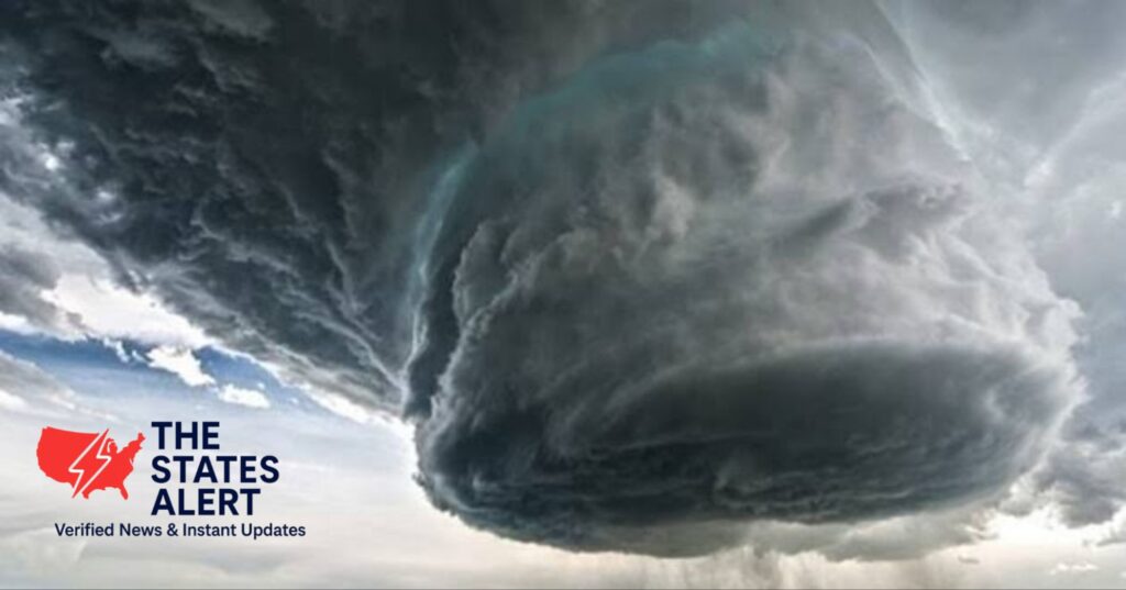
A fierce and rapidly moving storm system set off multiple tornado warnings across southern Minnesota late Friday night, leaving thousands in the dark and causing significant damage to properties in several counties.
The National Weather Service (NWS) confirmed that intense thunderstorms were brewing, with the potential to produce tornadoes, prompting emergency alerts and real-time evacuations throughout the area.
🔴 Live Tornado Threat and Emergency Response :
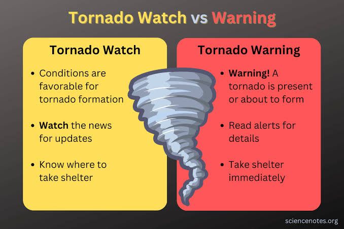
Tornado warnings have been issued for areas like Hokah, Hartland, and nearby rural communities.
Local officials are urging everyone to seek shelter right away as powerful rotating supercells move through the region.
In a gripping video shared live by storm chaser Scott Peake, viewers can see the moment when fierce winds ripped trees from the ground and lightning lit up the darkened sky.
This footage has quickly gone viral on social media, showcasing the sheer power of the storm.
Damage and Power Outages
Xcel Energy has reported more than 8,000 power outages throughout southern Minnesota, as fierce wind gusts topping 70 mph have knocked down power lines and broken utility poles.
In Hokah, witnesses described roofs being ripped off barns, streets turning into rivers from sudden heavy rain, and debris blocking rural roads.
Emergency crews jumped into action, quickly clearing major highways and working to restore essential services. However, it might take up to 48 hours to fully restore power in some of the more remote areas.
🌧️ What’s Fueling the Storms?
Meteorologists are connecting the recent outbreak to a phenomenon known as the “Ring of Fire.” This involves a high-pressure heat dome sitting over the central U.S., which is pushing moist, unstable air into the Midwest.
As a result, we’ve seen a series of severe storms stretching from Nebraska all the way to Wisconsin.
“This is textbook severe weather setup,” said NWS forecaster David Thompson. “The heat dome intensifies wind shear and creates the perfect environment for tornado development.”
What’s Next for Residents?
The National Weather Service is alerting us that stormy weather might stick around through the weekend.
We could see more isolated tornadoes, strong straight-line winds, and even flash flooding in eastern Minnesota and western Wisconsin.
Here’s what residents should do:
Keep an ear on NOAA weather radios or check official alerts on your mobile apps.
Make sure your emergency kits, flashlights, and phone chargers are all set and ready to go.
Try to avoid unnecessary travel and stay indoors during any lightning or storm warnings.